Teaching
Active, applied and place-based — students work on real maps for real partners.
Geography integrates human and environmental dimensions in the analysis of space, and our teaching follows that tradition. Courses use active learning and applied projects: GIS students audit campus accessibility with the Mapping Accessibility Project, and seminar students publish public-facing work on Wikipedia.
Courses at Western Washington University
ENVS 320 / 517 — GIS I: Introduction to Geographic Information Science
Spatial thinking, data acquisition, spatial analysis and map production in ArcGIS Pro, including data ethics and accessibility-aware mapping.
ENVS 418 / 518 — GIS II: Cartography and Geovisualization
Critical cartography, visual hierarchy, symbolization, typography and colour for static and interactive maps.
ENVS 421 / 521 — GIS IV: Geospatial Data Creation and Management
Capstone, team-based GIS projects with R-based workflows, map digitization and field data collection — with a recurring focus on campus and community accessibility.
ESCI 442 / 542 — Introduction to Remote Sensing
Physical principles of electromagnetic sensing, raster analysis and cloud computing in Google Earth Engine: spectral indices, machine-learning classification and time-series change detection. Open lab materials →
ENVS 401 / 504 — Introduction to Research Methods
Qualitative and quantitative research design, proposal writing and statistics in R; graduate students integrate mixed methods.
ENVS 201 — Understanding and Communicating Environmental Data and Information
Data literacy through storytelling, exploration, basic statistics and visualization, ending in an infographic and a flash talk.
ENVS 334 — Extractivism in Latin America
Extractive industries through social, ecological, economic and political lenses, with a Collaborative Online International Learning (COIL) exchange with students in Ecuador and a public Wikipedia contribution.
Honors College — Extractivism and its Alternatives in Latin America (HNRS 350) and the Ecuador study-abroad course Navigating the Human Experience: Postmodernity (HNRS 105).
Senior projects — applied, community-engaged research on accessibility, spatial analysis and environmental decision-making.
Workshops and training
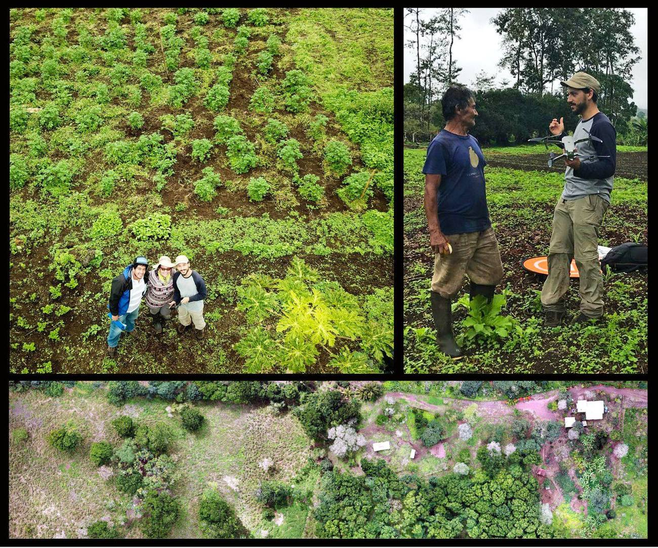
Hands-on workshops for the Galápagos Ministry of Agriculture on open-source GIS (2023) and drone mapping — flight planning, ground control and photogrammetry (2024; see the Spanish-language guide Uso de drones para la agricultura en Galápagos); GIS workshops for environmental educators and youth in the Galápagos; and guest lectures on drones in qualitative research.