LASO Lab — home LASO Lab — home
  • Research
  • People
  • Publications
  • Teaching
  • Join the lab

Now recruiting: a funded M.A. student for Fall 2027 — Galápagos & Ecuador, or accessibility mapping. Get in touch by January 10. Details →

Environmental Studies · Western Washington University

Mapping what maps leave out.

LASO Lab uses remote sensing, GIS and participatory mapping to bring into view the species living on farms, farmers’ own knowledge, and the barriers disabled people meet every day — working with the people concerned, on their terms.

See our research Prospective students

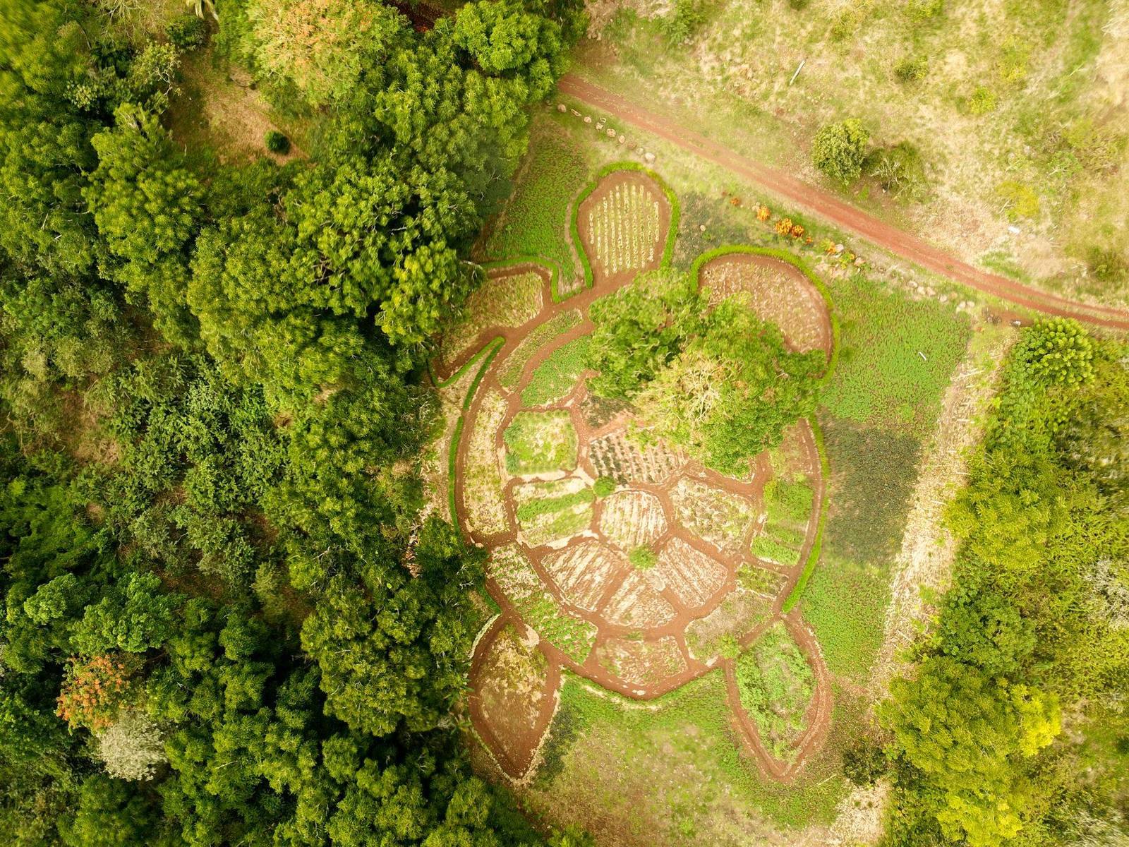
Drone view of a Galápagos highland farm with a garden laid out in the shape of a giant tortoise
Landscape
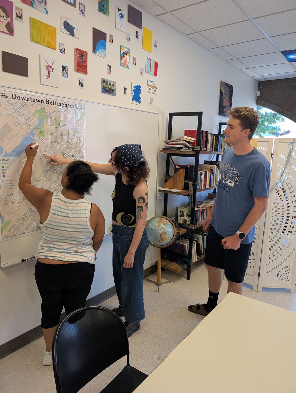
Community members adding notes to a large printed campus accessibility map
Accessibility
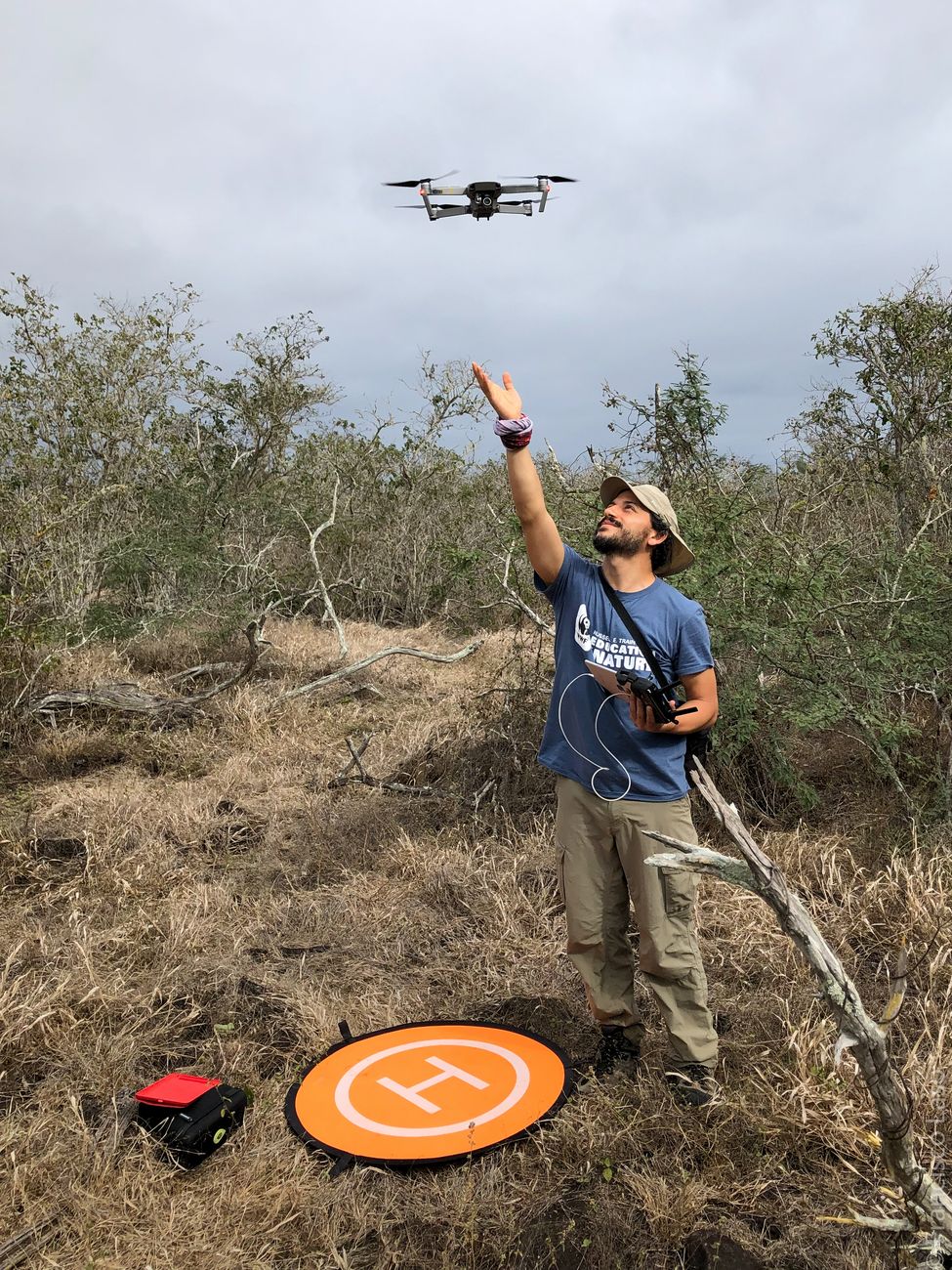
Francisco Laso hand-launching a mapping drone in dry scrubland
Spatial observation

What we study

Three threads, one in each letter of our name.

L

Landscape

How farming and conservation share land — land-cover change, invasive species and agroecosystems, with a long-running focus on the Galápagos highlands and mainland Ecuador.

A

Accessibility

Mapping barriers, and barrier-free routes, together with disabled people — so maps reflect lived experience, not just building plans.

SO

Spatial observation

The tools behind both: satellites, radar, drones, LiDAR and field data, processed in Google Earth Engine, R and GIS — and shared as open, bilingual tools.

Projects

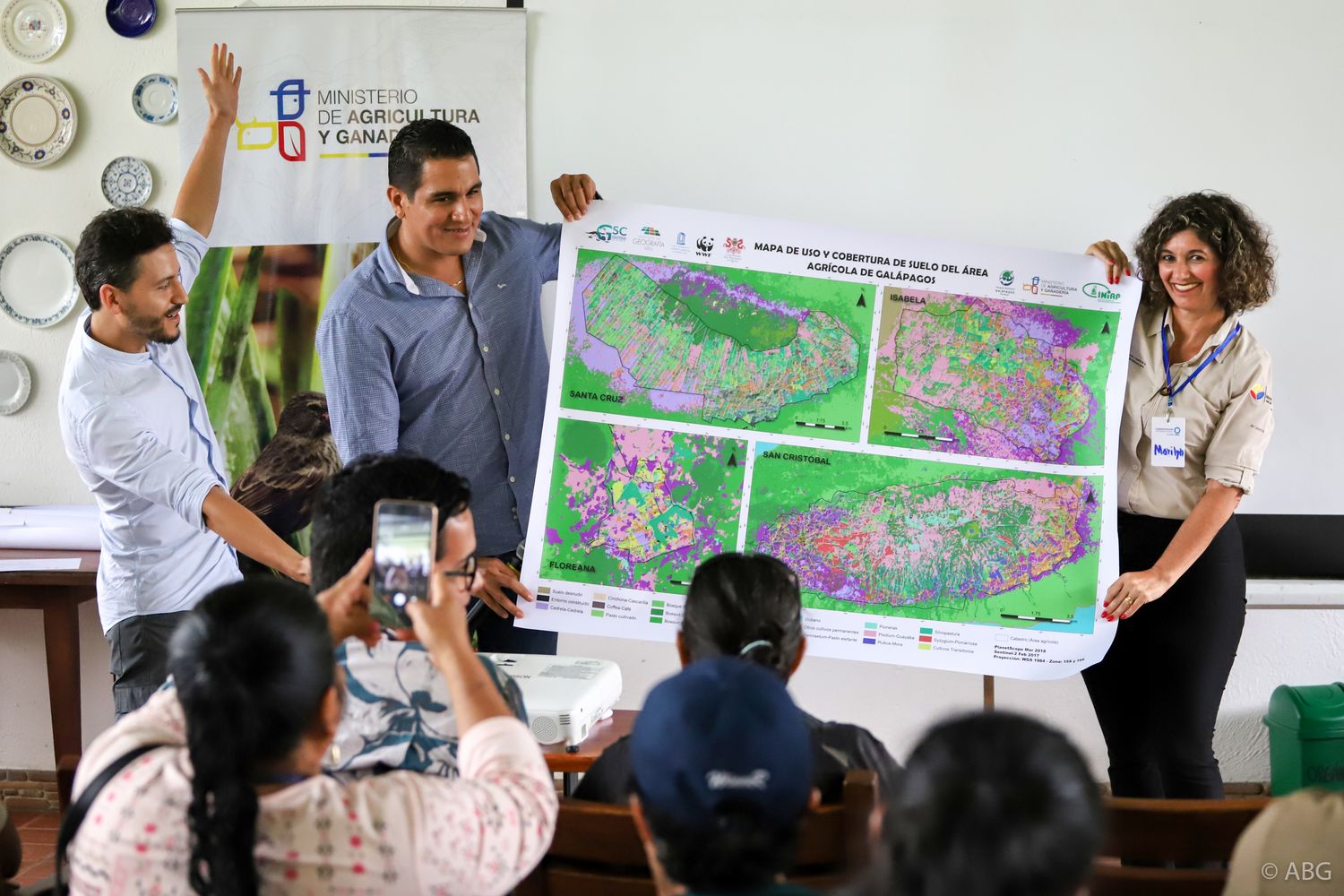
Francisco Laso and colleagues presenting a large land-cover map to an audience in the Galápagos

Landscape · Spatial observation

Galapagos Agroecological Observatory

A long-term observatory of the farming highlands of four inhabited islands, built with farmer families, USFQ, Heifer Ecuador and local partners: satellites and radar above the garúa, drones and field sampling below it.
Read more Observatory website Explorer map app
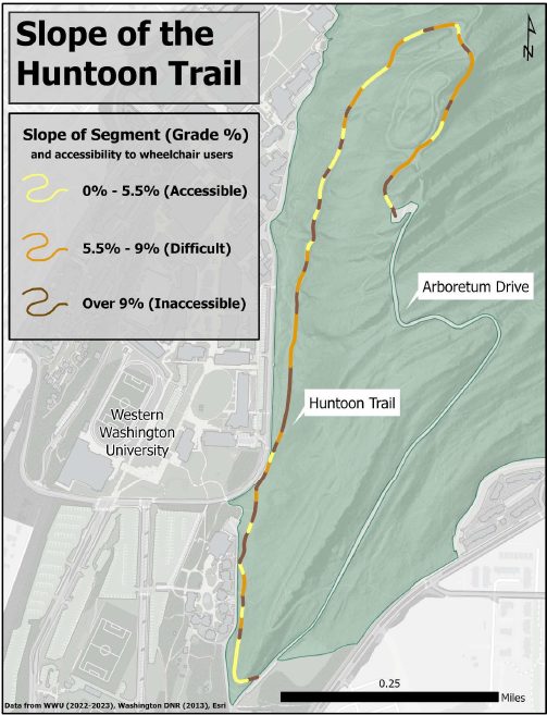
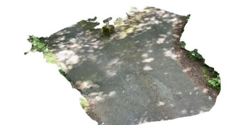
Map of the Huntoon Trail colour-coded by slope into accessible, difficult and inaccessible segments 3D LiDAR scan of a forest trail segment in the Sehome Hill Arboretum

Accessibility · Spatial observation

Mapping Accessibility Project

Participatory mapping of the WWU campus and the Sehome Hill Arboretum. Student teams audit entrances, automatic doors, sensory spaces and trail slopes, and write plain-text routes for screen-reader users.

Read more

Join the lab

We are recruiting a funded M.A. student in Environmental Studies for Fall 2027, in one of two tracks — the Galápagos and Ecuador, or accessibility and participatory mapping — or with your own spatial question. Undergraduates are welcome year-round.

See openings

Selected publications

  • 2026 · Agricultural Systems
    Trajectories of farming systems reshape land use/land cover dynamics in the agricultural zones of the Galapagos Islands
    Benítez, F. L., Mena, C. F., Laso, F. J., Zapata, M. B., Rivas-Torres, G., & Gobin, A.
    https://doi.org/10.1016/j.agsy.2025.104506
  • 2020 · Drones
    Drone-based participatory mapping: examining local agricultural knowledge in the Galapagos
    Colloredo-Mansfeld, M., Laso, F. J., & Arce-Nazario, J.
    https://doi.org/10.3390/drones4040062
  • 2020 · Remote Sensing
    Land cover classification of complex agroecosystems in the non-protected highlands of the Galapagos Islands
    Laso, F. J., Benítez, F. L., Rivas-Torres, G., Sampedro, C., & Arce-Nazario, J.
    https://doi.org/10.3390/rs12010065

All publications →

LASO Lab · Environmental Studies · Western Washington University · Bellingham, WA

 
  • Google Scholar

  • ORCID

  • ResearchGate

  • LinkedIn

  • lasof@wwu.edu